Archaeology Project
Our company was entrusted with a landmark project by the Department of Archaeology to execute a large-scale, technologically advanced survey and documentation initiative for State Protected Monuments across Maharashtra. This project aimed to create a definitive digital archive for conservation, research, and heritage management.
Project Scale & Reach:
Total Divisions Covered: 3 (Pune, Ratnagiri, and Chhatrapati Sambhaji Nagar)
Total Monuments Surveyed: 151+ monuments across the state, encompassing a diverse range of heritage structures including forts, temples, wadas, samadhis, caves, tombs, and prehistoric sites.
Our Scope of Work & Expertise
We provide end-to-end solutions for heritage documentation, combining cutting-edge technology with rigorous archaeological methodology. Our integrated survey approach ensures the highest level of accuracy and detail.
Advanced Survey Techniques We Employ:
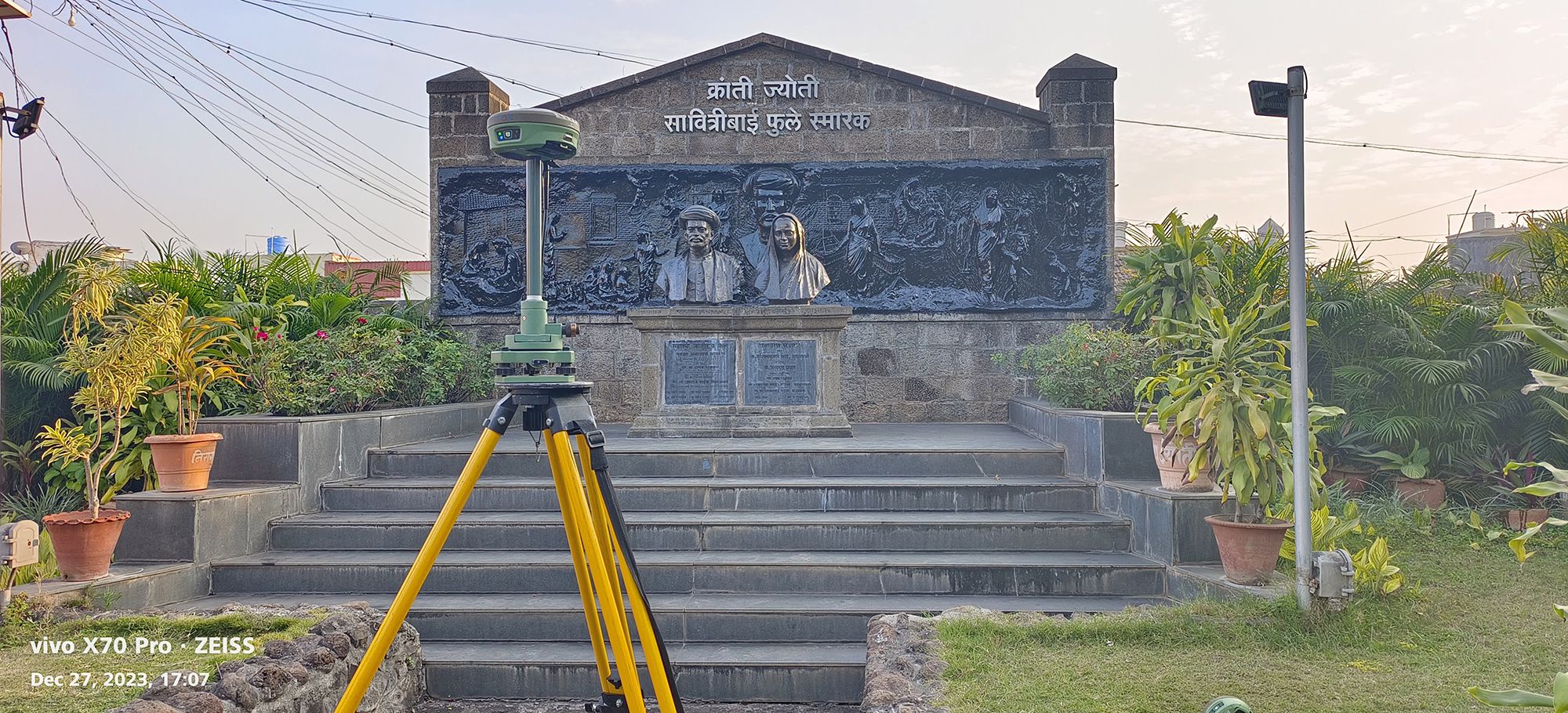
DGPS Survey: We utilize Differential GPS to establish highly accurate ground control points. This provides the essential geospatial framework, ensuring all collected data is precisely geo-referenced for reliable mapping and integration.
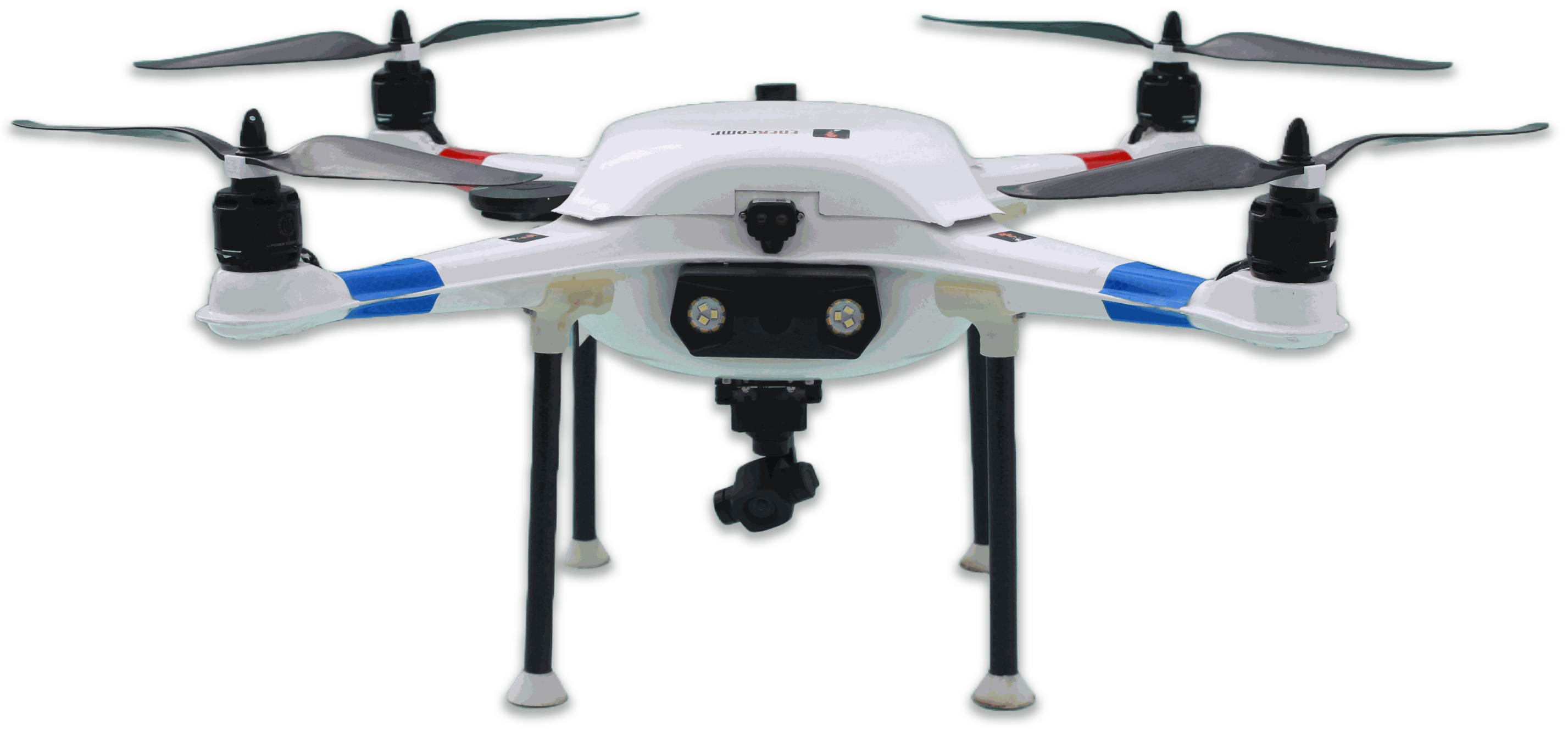
Aerial Drone Photogrammetry: Our drone-based surveys capture high-resolution imagery from multiple angles. This method is ideal for creating detailed 3D models and maps of monument exteriors and their broader topographical context.
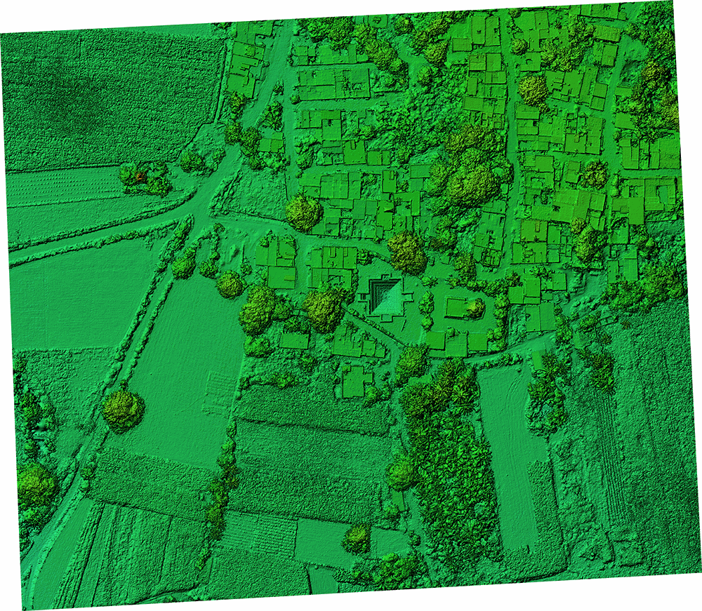
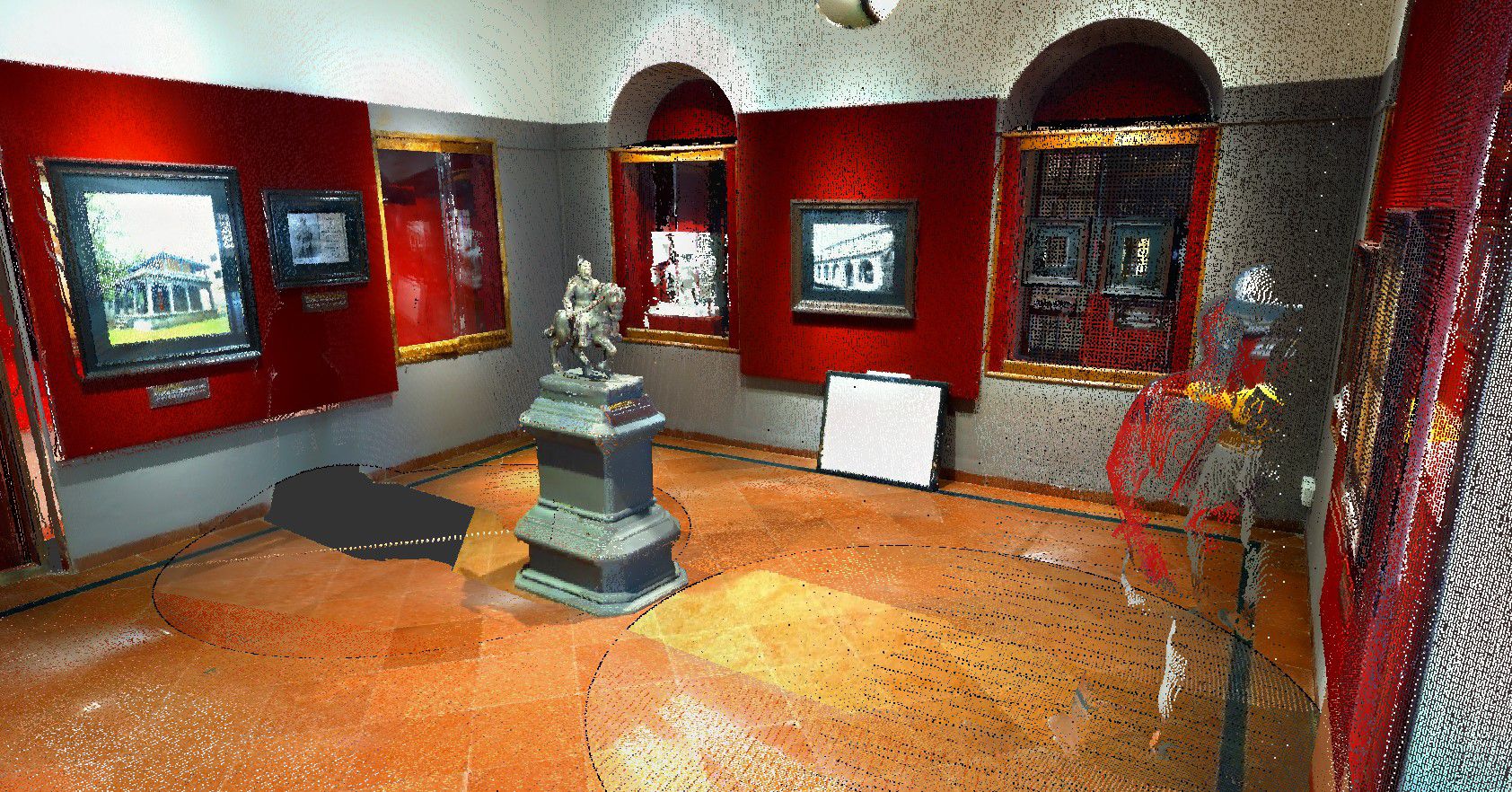
Terrestrial LiDAR Survey: For capturing complex geometries, interiors, and areas under dense vegetation, we deploy terrestrial LiDAR scanners. This technology emits millions of laser pulses to generate a massive, precise "point cloud" of the structure, capturing every detail without being affected by light conditions.

Digital Outputs & Deliverables
We transform raw survey data into a comprehensive suite of actionable digital products for analysis, planning, and visualization.
Key Outputs We Generate:
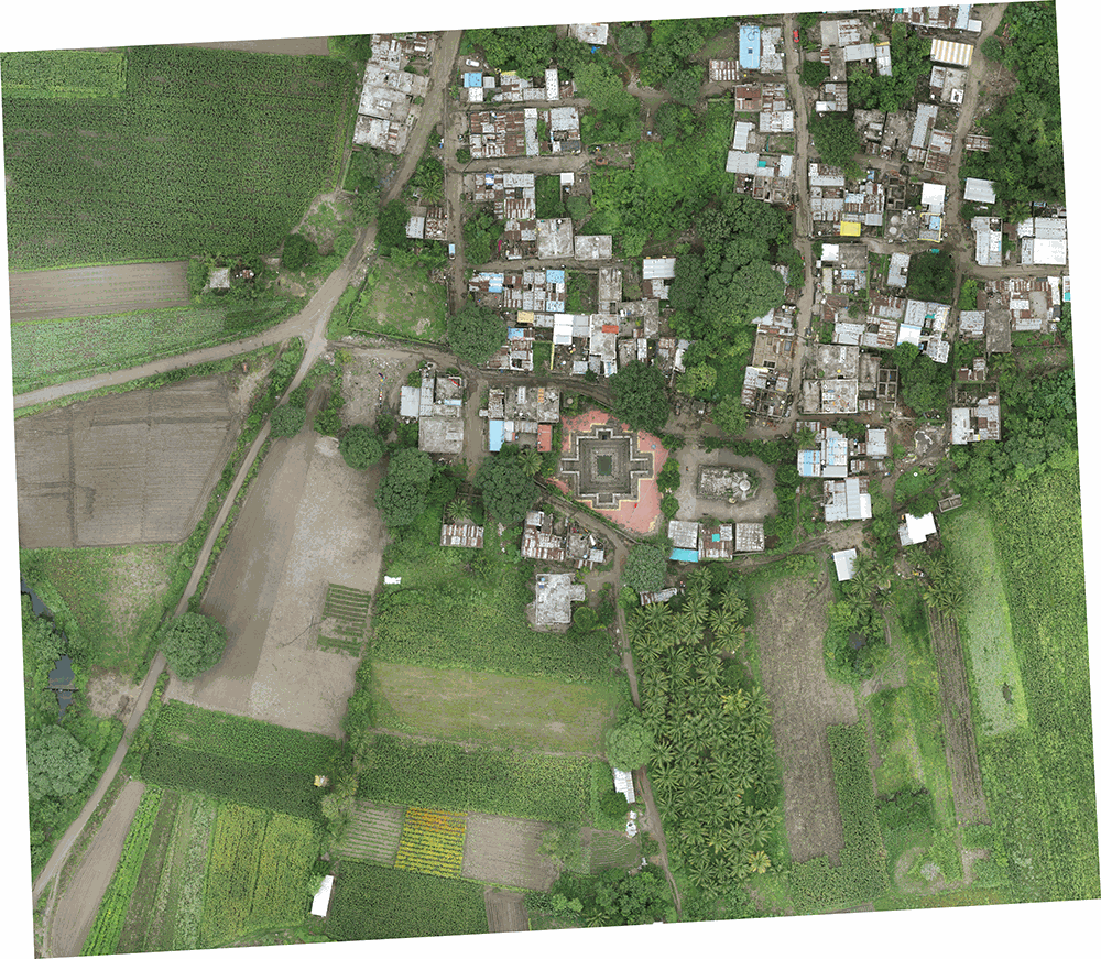
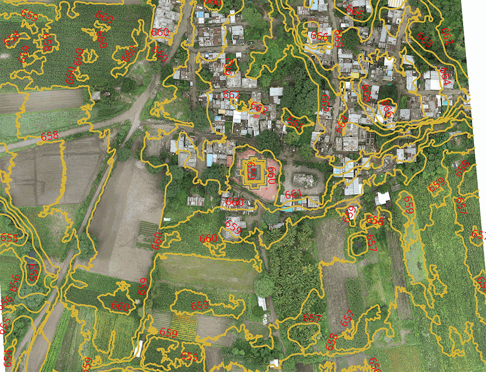
Orthomosaic Maps: High-resolution, georeferenced aerial maps that provide a true-to-scale "bird's-eye view" of the site, perfect for detailed planning and measurement.
Digital Surface Models (DSM) & Digital Terrain Models (DTM): DSMs represent the earth's surface, including all structures and vegetation, while DTMs depict the bare ground topography. These are crucial for understanding drainage, landscape, and terrain.
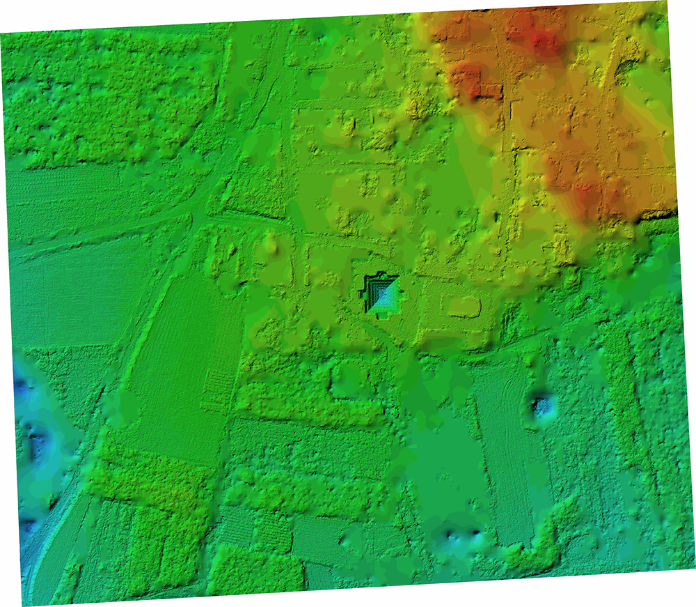
Contour Maps: Detailed contour lines derived from the DTM/DEM, essential for architectural and civil engineering planning on the site.
Architectural Drawings: We produced detailed architectural drawings that form the backbone of structural understanding and conservation planning.
Formats: Provided in both digital (DWG/CAD) and physical hard copies (A0, A2, A3 sizes) as required.
Condition Assessment: Drawings are often augmented with condition assessments, highlighting cracks, damage, and modern additions.
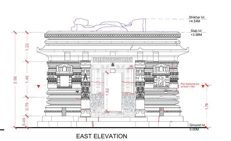
Purpose: These reports are indispensable for conservation architects, archaeologists, and government bodies for informed heritage management.
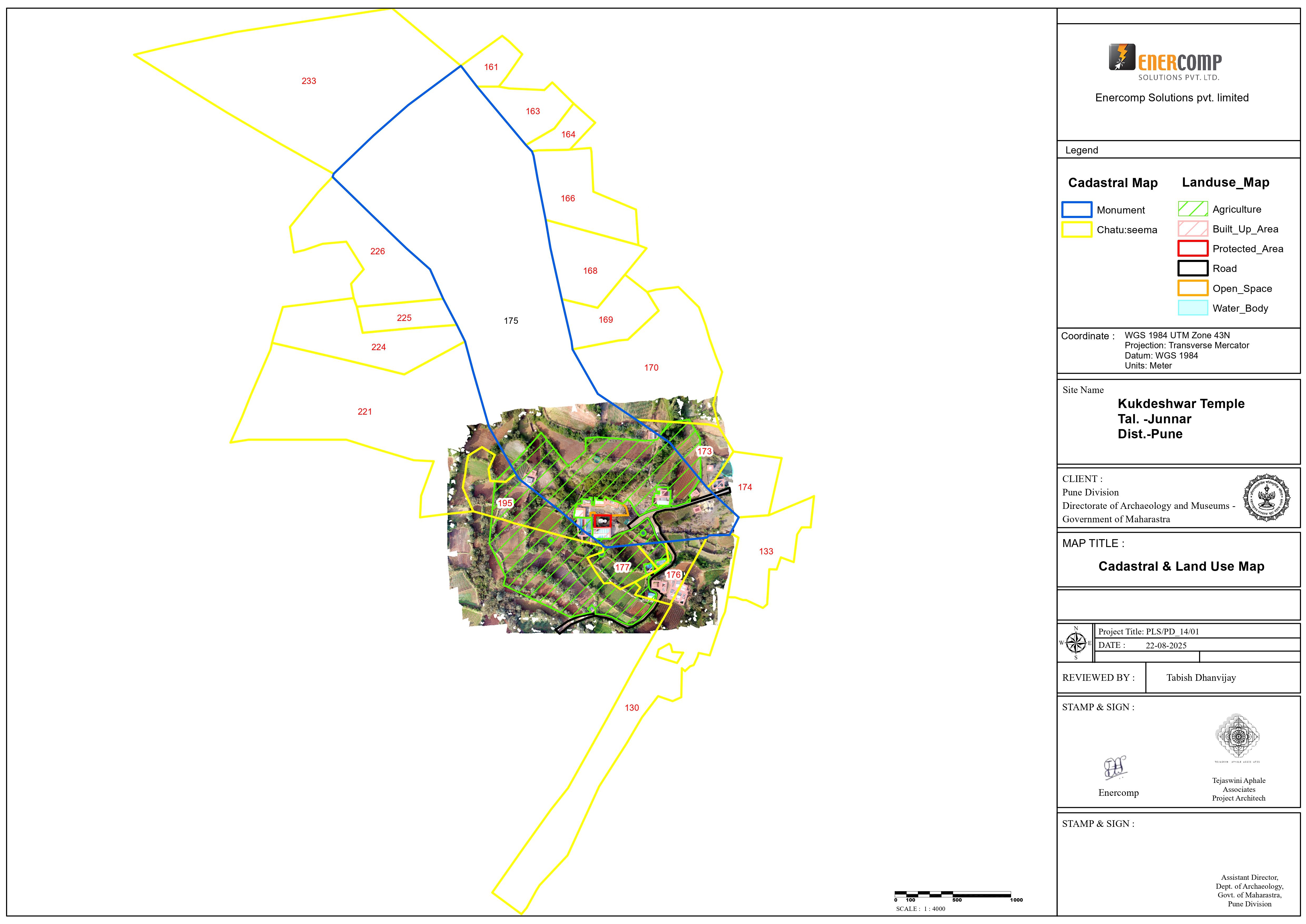
Cadastral & Land-use Maps: We provide critical data for land management and legal protection of heritage sites.
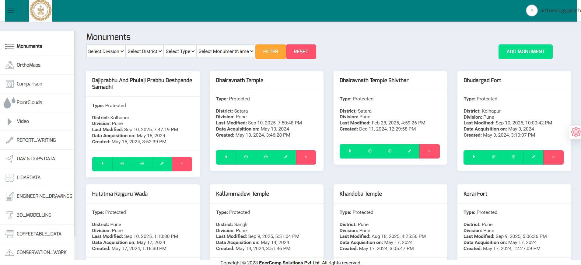
Data Visualization & Management Dashboard
To make this wealth of data accessible and usable, we developed a custom, web-based dashboard.
Centralized Repository: All project data—including orthomosaics, DSM/DTM, 3D models, point clouds, reports, and drawings—is integrated into a single, secure platform.
Advanced Features:
View and overlay multiple 2D and 3D data layers.
Take accurate linear, area, and volume measurements directly from the models.
Facilitate before/after monitoring of conservation work.
Access the entire digital archive online from anywhere with secure login credentials.