Slum Mapping with UAV
Land Survey & Mapping
As a result of rapid urbanization, slum population in India is proliferating tremendously.
Challenges :
Carrying out
What Next:
Drones equipped with camera and sensors if deployed to study the slum
Solution We Provide:
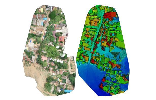
We deploy a fleet of drones to map around depending upon the numbers of slums to give faster and accurate results. We clearly identify boundaries with
What We Deliver:
·
Orthomosaics of the entire road/railway network in
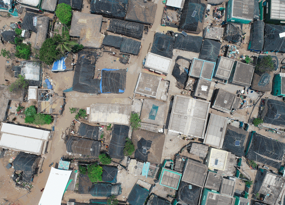
· Orthomosaics of individual slums in GeoTIFF format at 1cm/pixel accuracy
· Point clouds/3D Models with 2cm/pixel accuracy in Z direction for future infrastructure planning in that area
· Digital surface model with a cell size of 0.040m covering the entire slum area
· A quality report stating estimated accuracies and how quality assessment is done
Why We?
· Our precision mapping techniques using drone help in identifying and creating an inhabitable environment
·
Our
· We excel in providing better granular data, especially in densely populated slums where boundaries are difficult to be identified