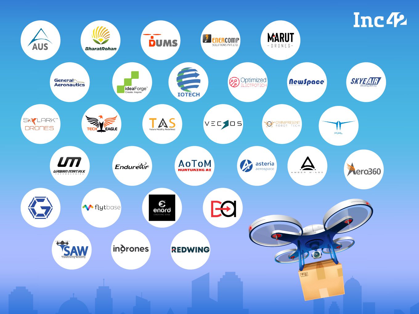
30 drone startups taking over skies
Featured in INC 42
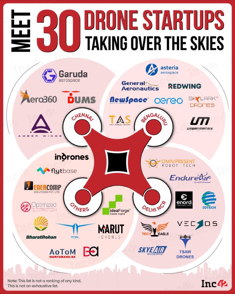
Eyes In The Sky: 30 Indian Drone Startups Looking For A Major Pie
India has witnessed a 34.4% surge in the number of drone or UAV startups between August 2021 and February 2022
The annual sales turnover of the drone manufacturing industry may grow from INR 60 Cr in FY21 to over INR 900 Cr in FY24
Civil Aviation Minister Jyotiraditya Scindia said that India has the potential to become a global drone hub by 2030
Raksha Mantri RajnathSingh inaugurates the Bharat Drone Shakti 2023 at the Indian Air Force airbase in Hindan Ghaziabad
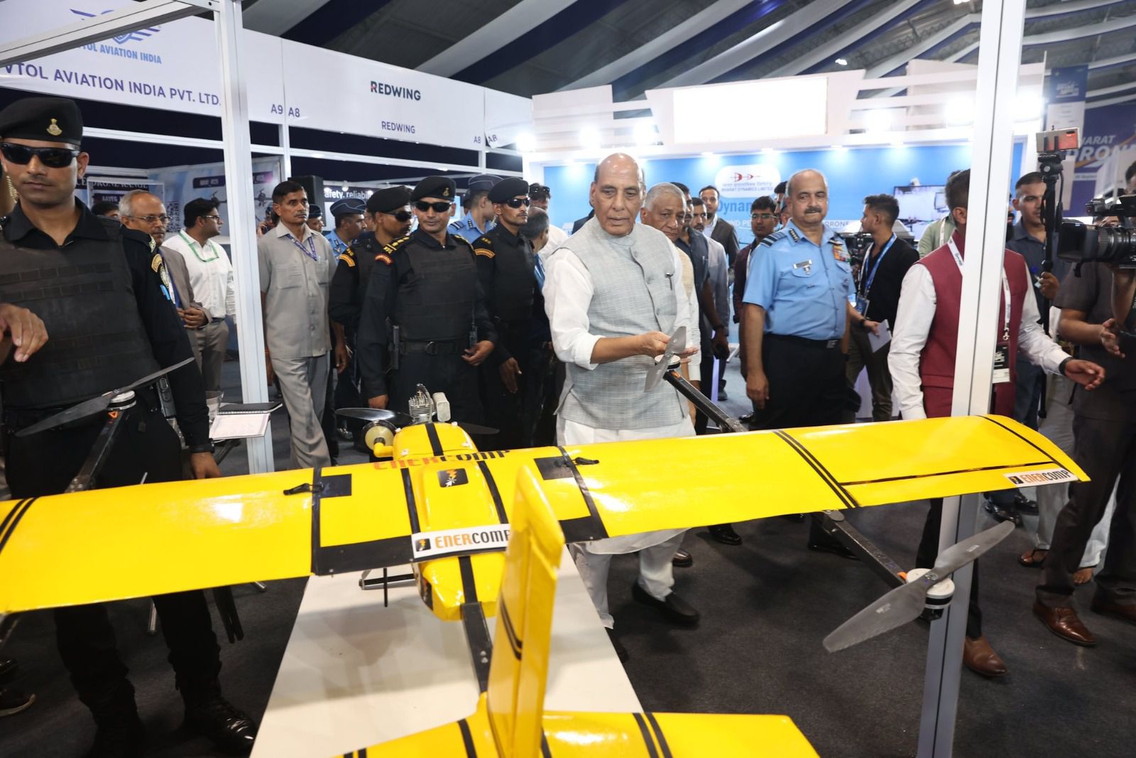
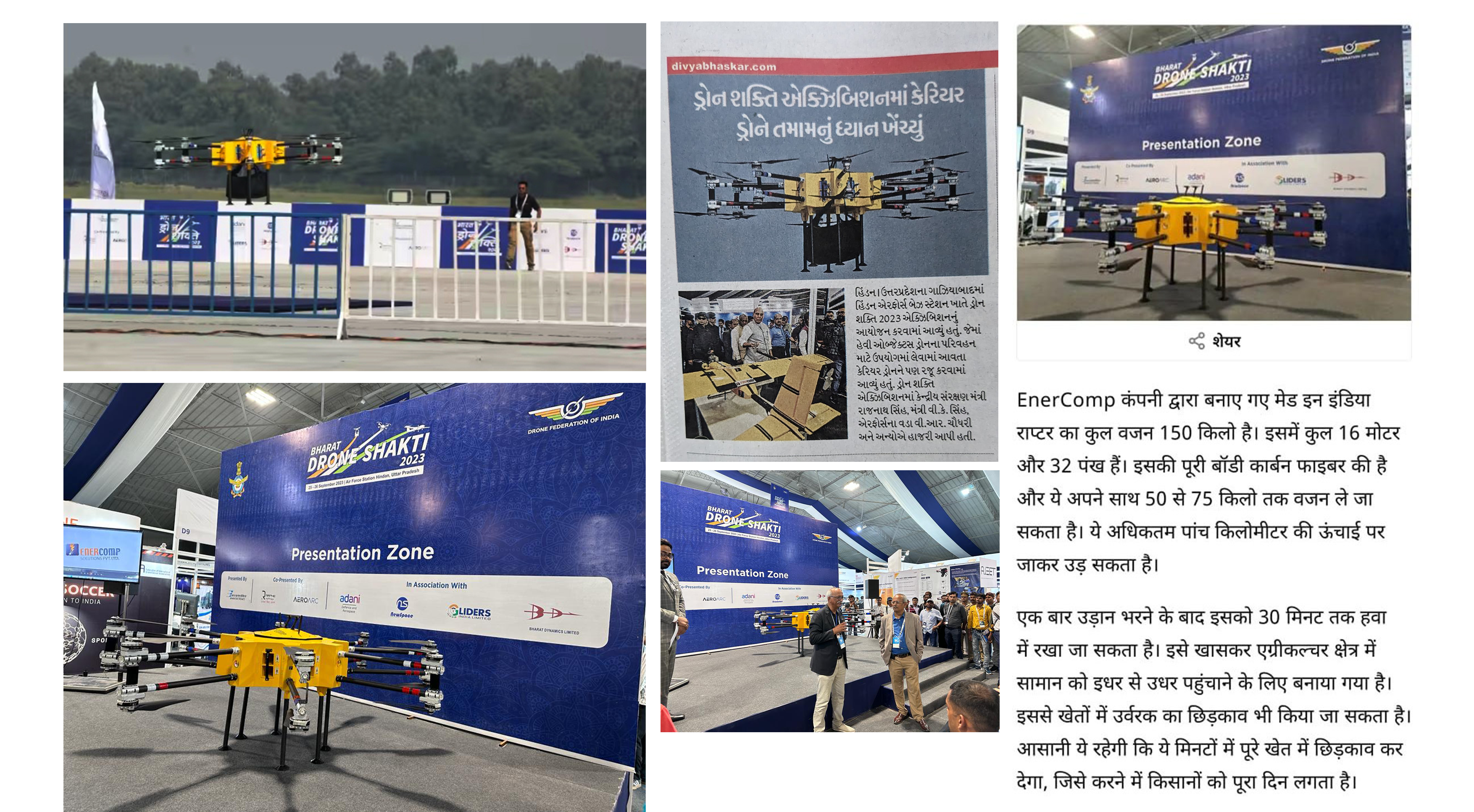
It's a platform to connect with a wide array of buyers and industry stakeholders. Heavy logistics Raptor drone were put on display on second day of Bharat Shakti-2023 exhibition on Sept 26.


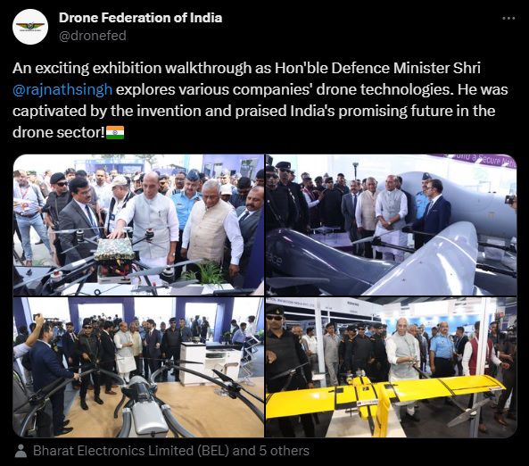
Throughout the event, we conducted captivating live demonstrations, effectively showcasing the impressive capabilities of our drones and their adaptability for customization to address specific industry needs. The palpable enthusiasm and keen interest exhibited by our visitors fostered numerous substantive dialogues, revolving around the prospective integration of drone technology within their operational frameworks.
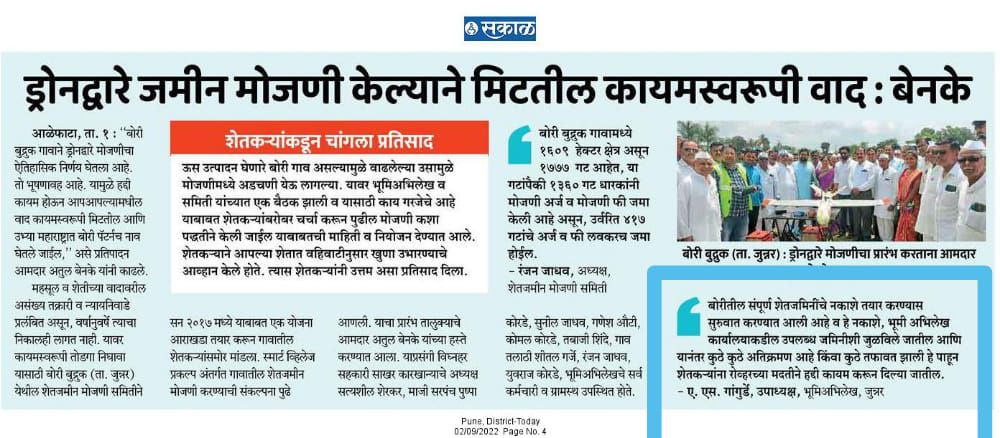
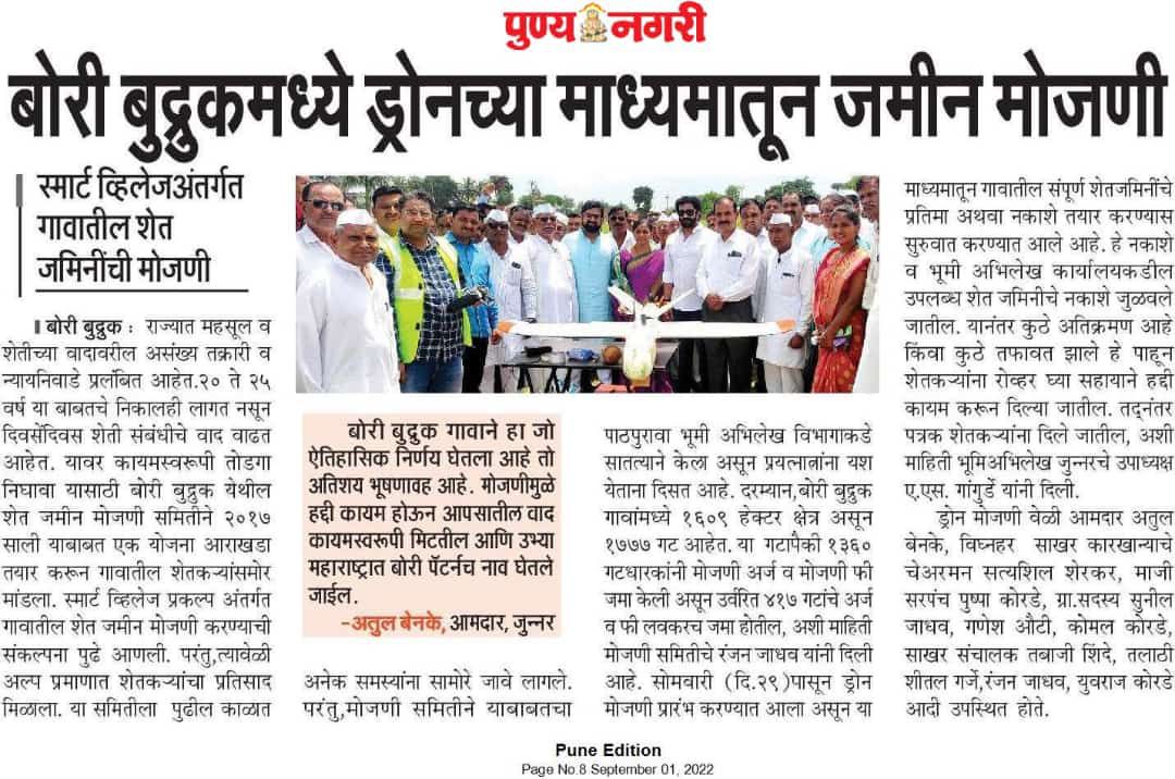
LAND RECORDS DEPARTMENT USES DRONES FOR MOJANI
In order to have quick turn around in pending mojani cases, Land records department of MH decides to do POC with drones to have measurements done. Enercomp is happy to help !!.
LAND RECORDS DEPARTMENT USES DRONES FOR MOJANI
In order to have quick turn around in pending mojani cases, Land records department of MH decides to do POC with drones to have measurements done. Enercomp is happy to help !!.
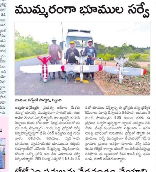
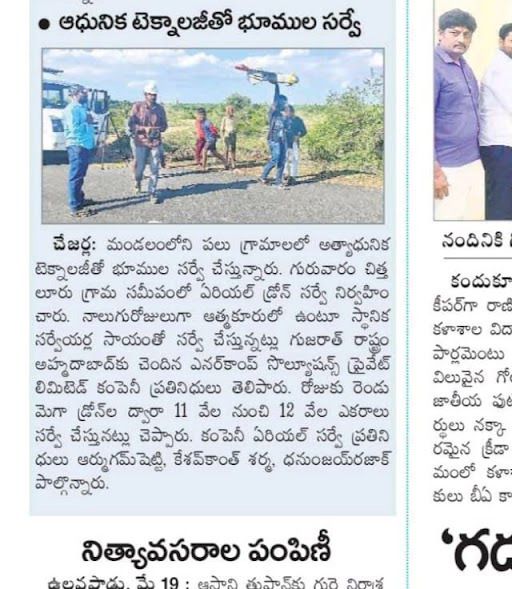
Covered for AP LSM ( Large Scale Mapping using Drones )
Enercomp is working on a subcontract for mapping large scale areas in AP using fixed wing drones which covers per day about 15-20 sq. km area with 1 drone.
1.Saakshi Daily Newspaper 2.AndhraJyothi Daily Newspaper 3.Eenadu Daily Newspaper

Covered for AP LSM ( Large Scale Mapping using Drones )
Enercomp is working on a subcontract for mapping large scale areas in AP using fixed wing drones which covers per day about 15-20 sq. km area with 1 drone.

Featured in INC 42 - Drone Startups India
Eyes In The Sky: 12 Indian Drone Startups Looking For A Major Pie
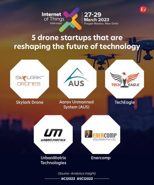
Enercomp Featured by Internet of Things
Drone Startups making difference.
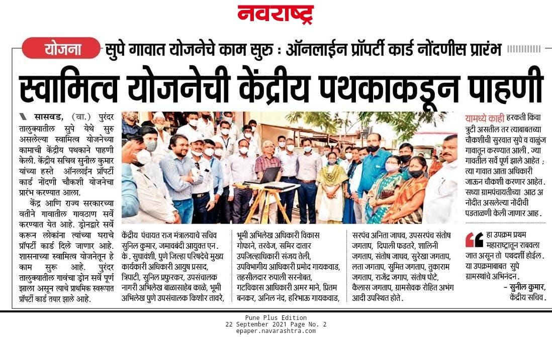
Enercomp contribution for SWAMITVA
We are engaged by Maharastra Land records for Swamitva project
We closed our first-round,Thank You
Thank you investors for your faith !!
https://yourstory.com/2021/09/funding-drone-ai-tech-startup-enercomp-angel-round/amp

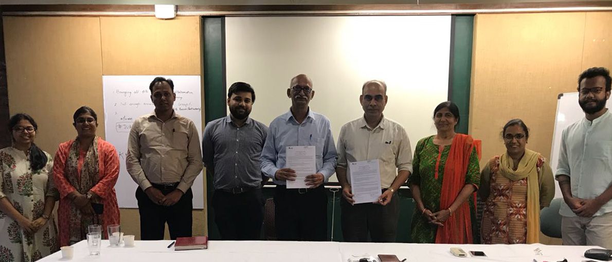
MOU signed with CEPT University
Aerial drones have been making headlines over the last decade, mostly for their military applications. However, more recently, many civilian agencies and private organizations have been acquiring the technology of Drones - Unmanned Aerial Vehicles (UAVs), thus becoming prevalent in various sciences and thematic applications.
As the utilization of multi-sensor, drone acquired data has increased manifold in various application domains (Geosciences, Construction Technology, Energy, Utilities and Infrastructure, Energy, Environment, etc.) or monitoring and surveillance activities, a MoU has been signed between Faculty of Technology, CEPT University and Enercomp Solutions Private Limited, on 5th September 2018.
This Industry–Academic MoU shall allow mutual exchange, of better understanding the research and applications of Drone/UAV technology for the Habitat studies, right from planning for a drone flight to acquiring, processing, analyzing and utilizing the high-resolution image information and its secondary derivatives for better decision making in a particular application.
Enercomp is a Drone based aerial data Solutions Company which integrates custom-built drone and intelligent algorithms to provide complete and cost-effective solutions across key sectors of the economy. They are involved with aerial surveys for areas such as Energy, Roads, Railways, Highways and Slums, along with utilization of proprietary image processing algorithms to provide meaningful reports. The company has several years of expertise in various sectors such as Utility, IT and Drone based surveys, providing solutions in Aerial Photogrammetry, High resolution Mapping-Surveying and Modelling, On-shore/Off-shore inspection and monitoring, etc.